
ADAM ANIK/ FOR MONTCLAIR LOCAL
By Jaimie Julia Winters
winters@montclairlocal.news
Underneath much of Montclair runs a bubbling brook covered and culverted long ago to make way for sewers and development. The environmental commission now sees an opportunity with the redevelopment of Lackawanna station, where Toney’s Brook was covered and hidden in the early 1900s, to explore uncovering the waterway to be included in a park with a water feature.
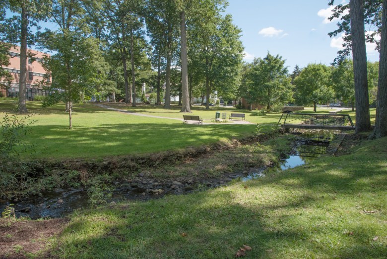
Toney’s Brook is a tributary of the Second River in Essex County. Named for Anthony Oliff, a resident of Montclair, Toney’s Brook originates in Montclair northwest of the Upper Montclair railway station. In Montclair, it is joined by two tributary streams and continues through Anderson Park, Edgemont Memorial Park, Montclair High School and Glenfield Park. Some of it is culvertized (channeled with concrete) and covered, other parts open but culvertized such as on Walnut Street, while much of it remains in its natural state or near-natural state near Edgemont and the high school.

Map USGS Historical Topographic Map Explorer
Rather than being filled in, many streams in urban areas were channeled with concrete culverts and covered over. They still exist, and now some environmentalists are advocating for their rebirth through “stream daylighting” by uncovering and restoring them.
“In suburban Montclair, many streams have been placed within culverts or urbanized (located within concrete). In most cases this results in a reduction in the volume of water that can be carried by a watercourse. Once a stream is urbanized, the conditions that affect runoff, water quality, sediment and aquatic life within the watershed are changed permanently. This is likely the last, or one of the last, opportunities in Montclair, where such consideration can be given for enhancing and revitalizing one of its rare natural resources, as per the goals of the master plan,” said Catherine Outlaw, of the Montclair Environmental Commission. “This is a rare opportunity for the consideration of stream daylighting and creating additional green space in this part of town, which is lacking, especially when compared to other parts of Montclair.”
In addition, the commission pointed to Montclair’s FEMA map. Although the area is not within the flood zone, Outlaw said the culverts under the property seem to impact the upstream and downstream properties along Toney’s Brook.

Courtesy David Oguss
“The culvert under Lackawanna Plaza may constrict or alter flow in such a way that results in the adjacent properties being impacted and in a designated flood zone. The June 4, 2007 FEMA [report] mentions ‘serious potential flooding’ upstream from the Lackawanna Plaza, and current FEMA mapping shows how severe this potential flooding is and how it is constricted at the Lackawanna Plaza, likely the cause of the vast areas of upstream flooding,” she said.
As the streams were our first sewer systems it made sense they were buried, while others portions were built over with construction of homes, commercial development and roads, said Greg Pope, acting chairperson of Earth and Environmental Studies at Montclair State University.
Stream daylighting is becoming popular around the globe.
“Stream daylighting is a relatively new approach that brings these buried waterways back to life by physically uncovering and restoring them. Daylighting is an applicable technique to assist communities in reducing polluted runoff, addressing flash flooding concerns and improving the livability of the built environment,” said Amy Trice, of americanrivers.org, in the study “Daylighting Streams: Breathing Life into Urban Streams and Communities.”
The group advocates for daylighting of culverts and covered streams where possible to replenish nutrients to the waterways, and help with flood mitigation and create economic revitalization of surrounding areas with green space and water features. They suggest three options for stream recognitions: natural restoration – restoring a stream to natural stream conditions; architectural restoration — restoring a stream to open air, flowing water but within a constructed channel; or cultural restoration — celebration of a buried stream through markers or public art used to inform the public of the historic stream path, although the stream remains buried. The latter is typically used as a first step to build public support.
READ: MONTCLAIR 150, Gardens connect to community
READ: Will a smaller supermarket move Lackawanna along?
READ: Environment Commission to research open space tax
READ: Bonsal loses 70 trees in 48 hours
The Arcadia Creek in Kalamazoo, Mich., was buried underground for almost 100 years before portions were daylighted at a cost of $18 million as part of a major downtown redevelopment. The Saw Mill River, which flows through Westchester County before emptying into the Hudson River in Yonkers, was buried in the 1920s in response to development and rapidly expanding population at the cost of $19 million.
Daylight costs can be high depending on size of the project and obstacles with the restoration. A general rule of thumb is $1,000 per linear foot of stream daylighted; however, case studies have ranged in values from $15 to $5,000 per linear foot, according to Trice in her report. Government funding is available, especially if flood mitigation is involved.
Although daylighting offers many community, ecological and economic benefits, there are certain challenges associated with these projects.
“Streams in urbanized areas are generally buried beneath concrete and thus daylighting requires major excavation. Not only does daylighting require excavation of unwanted material, but restoration of some floodplain would provide the greatest benefit and is sometimes not physically possible in highly developed areas due to constraints imposed by adjacent infrastructure. If stream daylighting is possible, displacement of existing use areas such as parking lots are also problematic as well as obtaining necessary funding,” wrote Trice.
Pope said opening up even a portion of the stream could be problematic with flooding upstream or downstream and any such project should be an organized effort with neighboring towns.
“You are taking back 150 years, before development occurred and when there were slowing moving streams between marshes,” Pope said. Those marshes took in water overflow.
Parking lots built with permeable surfaces can be built to successfully recreate the marsh effect, he said.
Looking at the project holistically with other towns makes sense, said Keith Brodock , a planning board member and an environmental commission representative.

Courtesy Frank Godlewski
The location of the brook under Lackawanna could also be problematic. At Lackawanna, current maps with USGS Historical Topographic Map Explorer show the brook runs through the property at Greenwood and Glenridge avenues and under Grove through the east part of the property close to or under planned construction and paving. An older map from 1905, shows it entering more toward the center of the property dipping down toward Bloomfield, then back up in a U shape.
Although the environmental commission has not suggested a location for the brook if it were to be daylighted, they are asking that the idea be explored.
“We ask that the planning board consider tasking the applicant with exploring design alternatives that meet the goals of the Master Plan’s Conservation Plan component and study the culvert and stream in more depth and show how the new development may incorporate measures that can alleviate some of the upstream flooding,” said Outlaw.
Another option could be cultural restoration of the stream with markers denoting its history.
Sandra Chamberlin of the commission said Lackawanna meant forked streams to the Lenape Indians that once used the area. “We have buried the stream, covered it with a parking lot. Couldn’t we eek out a small portion to pay tribute to this one last piece of land and turn it into a small forest and parkland?” she said.